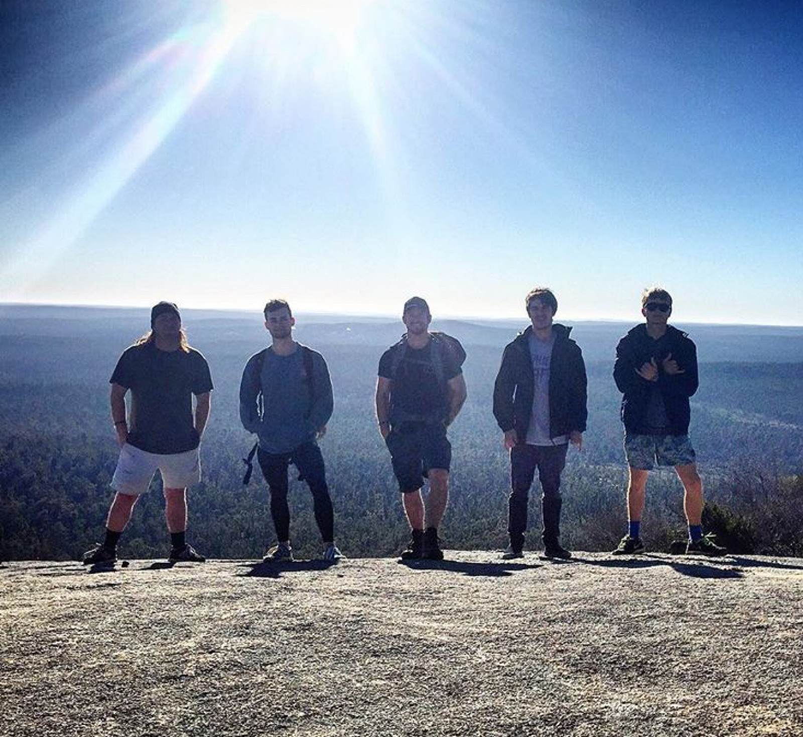
Mount Cooke
The summit of Mt Cooke is the highest point of the Darling Ranges and one of the many shorter walks you can do along the Bibbulmun Track. Spectacular views, this 16km hike is only partially marked and is approximately grade 4 in difficulty. For more information about the trails, you read this great article from Life of Py or view the Trails WA website.
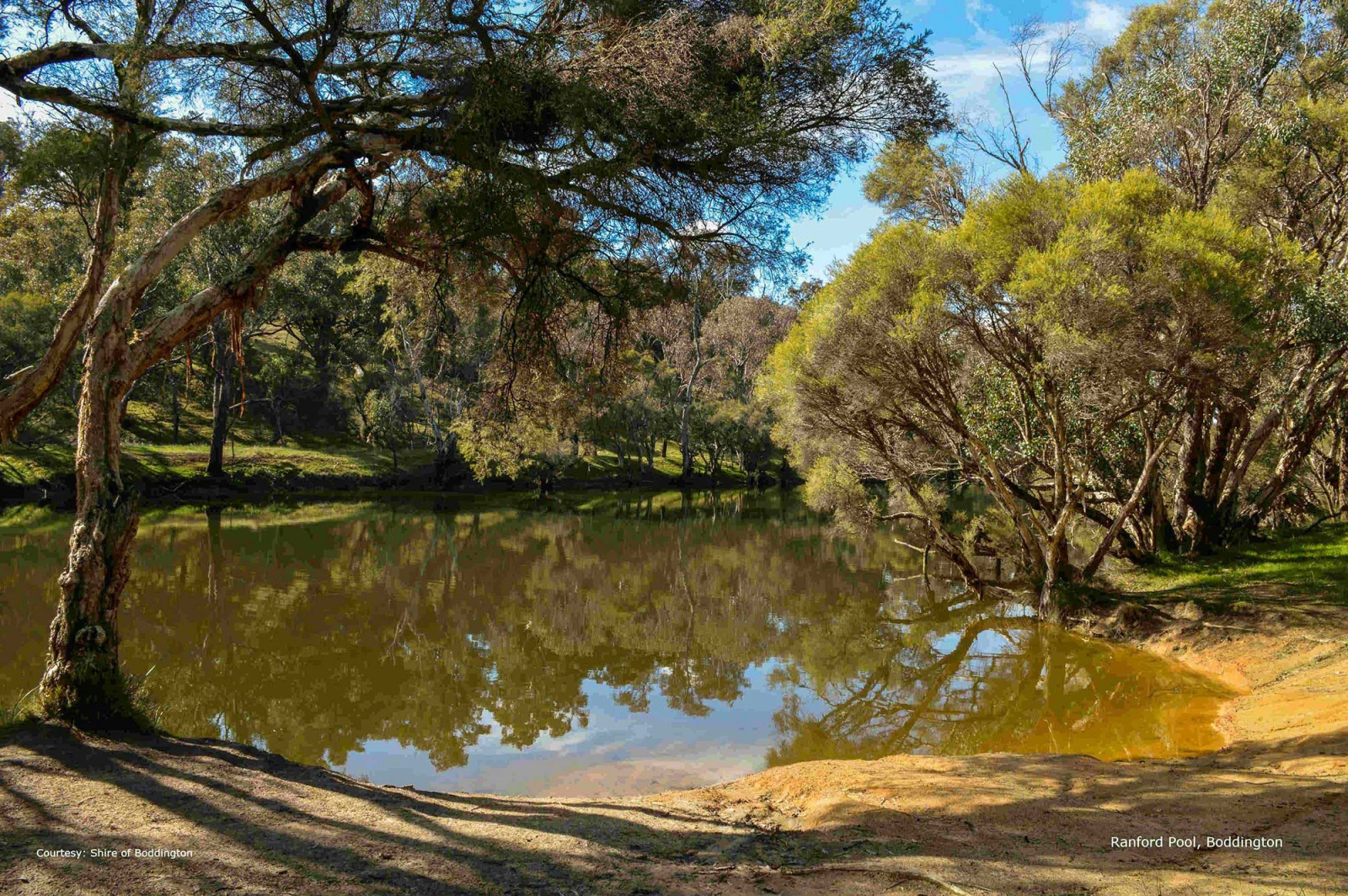
Ranford Pools
Fit for bushwalking or cycling, Ranford Pools is a beautiful 4km walk following an old railway line along the banks of the Hotham River to the historic Randford Pools. Fishing, canoeing, birdwatching and laying down the picnic rug are all favourite past times here.
For access to the trail, you can find more info here.
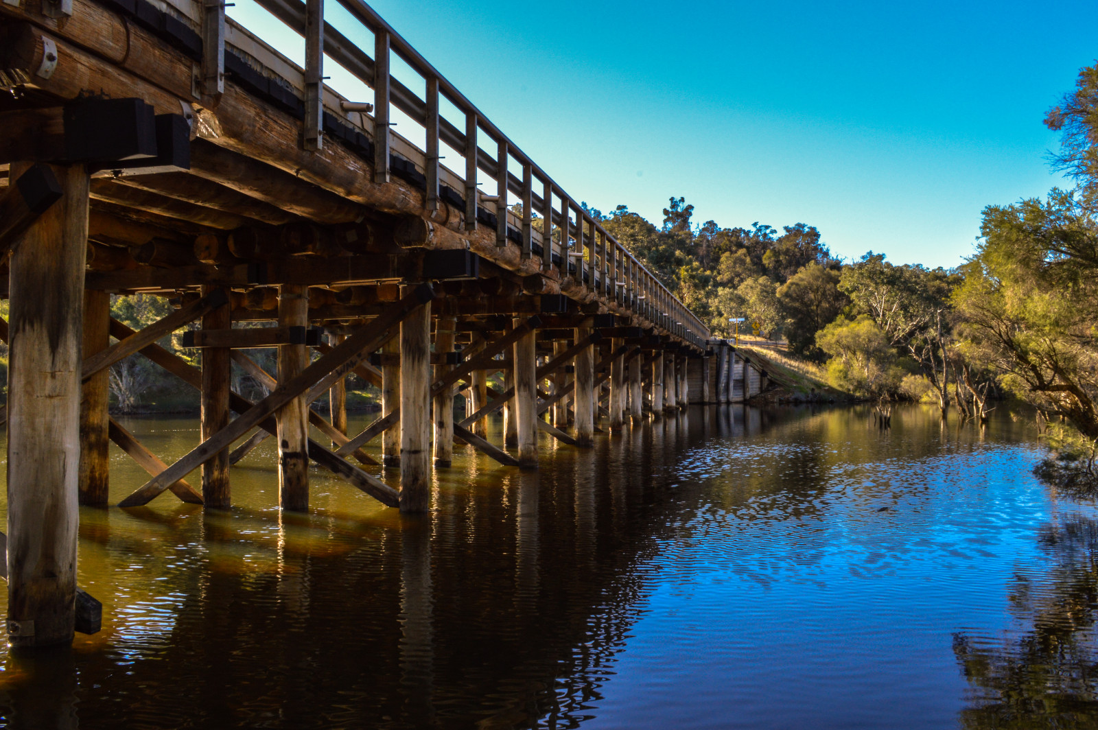
Tullis Bridge
Tullis Bridge is located approximately 9 kms out of Boddington and can be accessed via Morts Road off Farmers Avenue. The wooden trestle bridge was build in 1912 and was used to link the railway line from Pinjarra to Narrogin, initially for use by the timber industry. It continued to operate servicing the local timber & farming industries, up until 1968.
Sadly the timber bridge was partially destroyed by fire a few years ago, with only remnants of the unique structure remaining. At Tullis Bridge you can enjoy a picnic at the picnic tables or sit under the canopy of trees that stretch alongside the Hotham River. Toilets are available at this site.
More Info
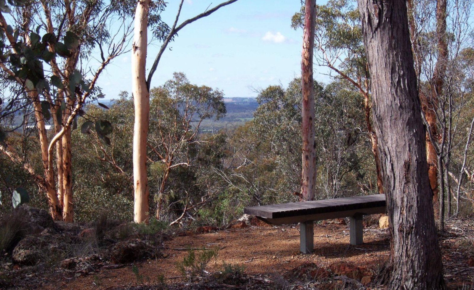
Dryandra Woodlands
Dryandra is home to a network of spectacular trails to satisfy a variety of fitness and enthusiasm levels. Whether on foot, cycling or driving, a trip through the nature sanctuary and eucalypt woodlands of Dryandra will stay with you for a lifetime. For a full list of trails you can visit the Trails WA website or view some of our favourites below;

Williams Nature Reserve
An easy drive up a gravel road to the picnic spot overlooking the Williams Nature Reserve is a lovely pit stop if you're in the area. Particularly spectacular during wildflower season between September and November.
The Williams Nature Reserve is located 10km north west of the Williams townsite.Turn off the Albany Highway into McKenzie Road, which is well signposted. It is hoped that a longer walktrail will be established at the site in the near future.
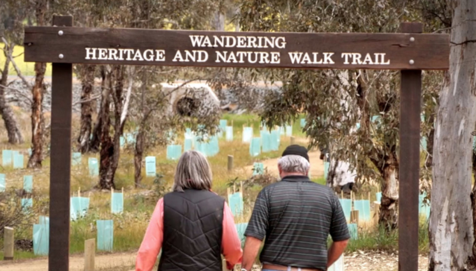
Wandering Heritage & Nature Trail
Take a meandering walk along the picturesque and historic Wologin Gully in Wandering, beginning at the Wandering Caravan Park.
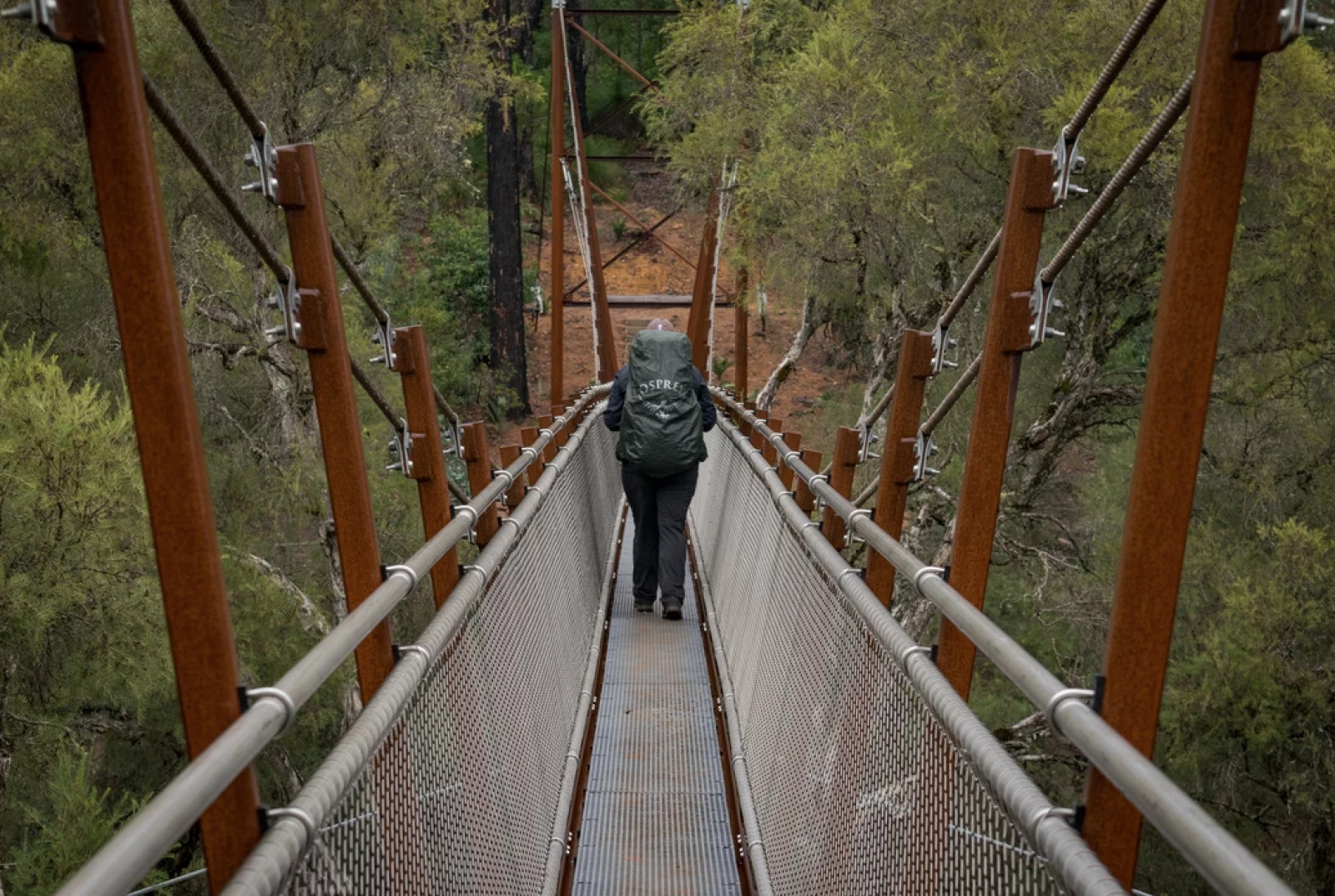
Long Gully Bridge to Bilya Djena Bidi Bridge Trail
For a more challenging trail, head into the heart of the Lane Poole reserve on one leg of the Bibbulmun Track. To get there, take a 30-minute drive approximately 35km from Quindanning along the Harvey-Quindanning Road.
The trail takes you on a 24km return trip along the Murray River beginning at the remains of the Long Gully Bridge which sadly burned down in the 2015 Boddington fires, through beautiful bushlands to the replacement Bilya Djena Bidi suspension bridge. This trail is largely unmarked and will require forward planning and research.
Our Supporters

The Shires of Williams, Boddington, Cuballing and Wandering acknowledge the traditional custodians of the Marradong Country region. We wish to respect their continuing culture and recognise the strength, resilience and capacity of Noongar people in this area
The Shires of Williams, Boddington, Cuballing and Wandering acknowledge the traditional custodians of the Marradong Country region. We wish to respect their continuing culture and recognise the strength, resilience and capacity of Noongar people in this area